WaiMAP - Spatial Intelligence

WaiMAP — Spatial Intelligence for Real Projects

Maps, data, engineering engines, AI and reports in one workflow

259 msmedian engine time to optimise the tower spotting of a 10 km, 400 kV line section — measured 2026-10-12 23:10 UTC on Intel(R) Xeon(R) Processor @ 2.80GHz, 2 cores, 10 runs. How it was measured Try it
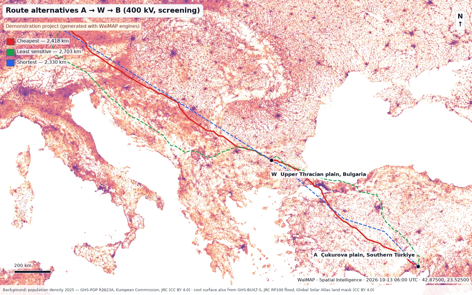
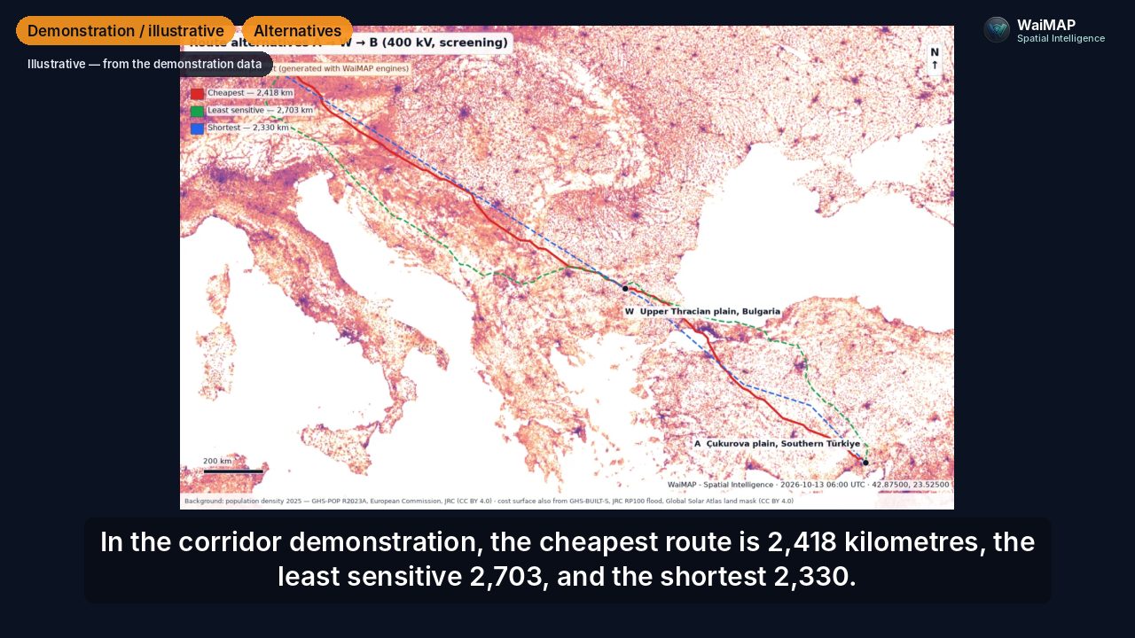
WaiMAP output: three route alternatives of a 400 kV transmission corridor from the Whitewell NPP area via Bulgaria to Bavaria on a population-density map, with the WaiMAP stamp and the data attribution
Demonstration project (generated with WaiMAP engines)Route alternatives computed by the WaiMAP line engine — read the story
Business lines

Five business lines. One workflow.

Each line shows a video, a demonstration project generated with the WaiMAP engines, its sample report and a direct way in.

All solutions and modules

The demonstrations are generated with the WaiMAP engines on open data — they are not real projects. Real project material is added only after client approval. Who WaiMAP is for · Video centre · Free Site Check

How it works

From data to decision in four steps

No installation. Open the map, follow the steps — every tool shows them.

01

Connect Data

Open data loads for the site (terrain, OpenStreetMap, climate, hazards, protected areas); add your survey, CAD, GIS, drone, document and time-series files.

02

Configure the Project

Choose the sector and the project type, draw or import the site, route or layout, and set the parameters — or start from a sample.

03

Analyze

Engines compute terrain, layout, energy, quantities, cost, finance and risks with stated methods, sources and assumptions.

04

Decide & Monitor

Reports, Excel, CAD and GIS deliverables for the decision; revisions, progress and site observations keep the project current.

Platform Capabilities

More Than a Map

How the solutions are delivered: one project, one map, many engines — each with stated methods, sources and outputs.

Full capability matrix

Spatial data & layers

A shared layer catalogue (terrain, energy, environment, risk, imagery, demand) with licence and attribution per layer; your Shapefile, KML, GeoJSON, DXF, GeoTIFF, LAS and Excel files.

Terrain & elevation

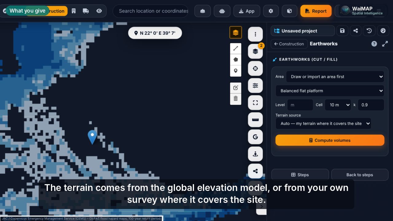
Global DEM or your own survey model, slope and aspect, profiles, cut / fill platforms, drainage, catchments and hazards.

Engineering & feasibility workflows

Solar, wind, BESS, hydropower, grid, lines, substations, water, earthworks, ground models — computed, with independent checks against open tools.

Project & asset data

One project with typed assets and IDs, named drawing revisions, analysis history, BoQ, programme and budget, shared with the team by code.

Satellite & drone imagery

A Sentinel-2 cloudless background (latest scenes when configured), drone orthophotos and point clouds, plans and photos placed on the map by control points.

Routing & networks

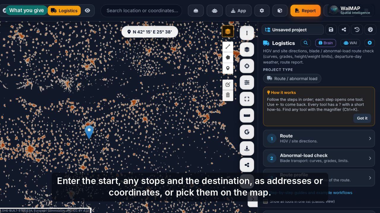
Truck routes with vehicle dimensions, abnormal-load checks, least-cost corridors for lines and pipelines, reach areas.

Change detection & monitoring

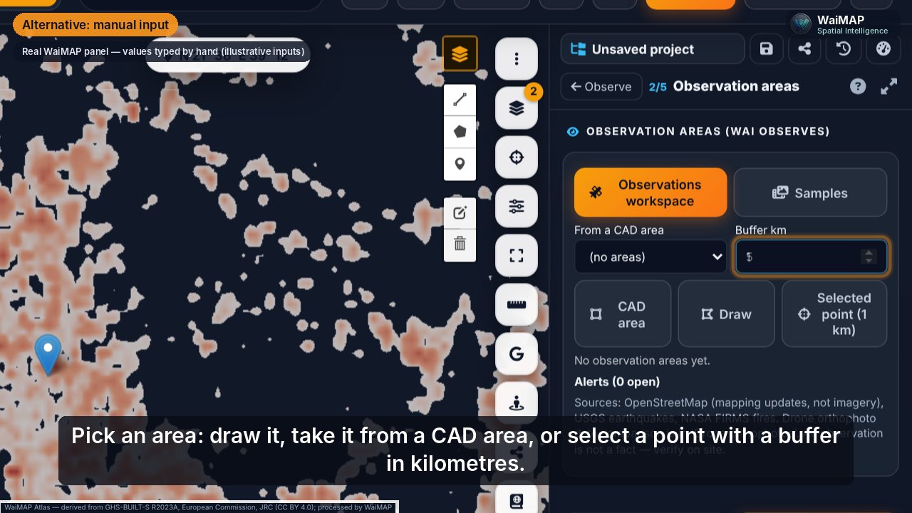
Observation areas compared with a reference date: mapping changes, earthquakes and active fires; drone orthophotos compared date by date; revisions compared element by element.

Reports, visualisations & APIs

PDF, PowerPoint, HTML, Excel, DXF, KML, GeoJSON, GeoTIFF; an MCP API for Business plans; QR verification of issued reports.

Change over time

Not only where — what changed

Revisions, observation areas, drone surveys and analysis history answer the same six questions.

Before

The reference: a saved revision, a baseline date of an observation area, an earlier orthophoto or analysis.

Now

The current drawing, the latest check, the newest orthophoto or a re-evaluation with new inputs.

What changed

Added, removed, moved or reshaped elements; new construction sites, roads or buildings in the mapping; events in the area.

Where

On the map, element by element, with the old position as a ghost and a click-to-zoom list.

How significant

Displacement and largest deviation in metres, length and area changes, alert severity, KPI differences between analyses.

Action needed

Open alerts to verify or dismiss on site, a comparison report and an Excel export for the team.

Trust

Built for Real-World Projects

Results you can check: where the data comes from, how the engines were tested, how a report can be verified and where the limits are.

Sample outputs

Reports generated by the engines from public data — open one, then run the same study on your site.

Sample reports

Data provenance

Every catalogue layer carries its licence and attribution; reports name their sources and dates; the Data Trust module keeps an evidence register.

Data Trust & Evidence

Validation evidence

Engines compared with open reference tools and published cases — values, differences, tool versions and dates.

Validation report

Report verification

Issued reports carry a serial; with verification active a QR code lets the reader check the file on the verify page.

Verify a report

Transparent limitations

Study level: concept, feasibility and early design. What WaiMAP does not do is listed, not hidden.

Scope and limits

Reports are a primary product

Every study ends in a document with an official cover (document no., revision, status, revision table, disclaimer). Depth varies by sector and module; the structure stays the same:

  1. Executive summary
  2. Location and site
  3. Maps and layers
  4. Data sources and observation dates
  5. Results
  6. Constraints, changes and anomalies
  7. Quantities and assumptions
  8. Findings, recommendations and limitations
  9. Appendices (tables, Excel, drawings)

Report levels

  • ScreeningIndicative results from open data and typical values for early decisions and internal use.
  • Feasibility-gradePre-feasibility / feasibility studies with your data, stated methods, independent checks and client-ready covers (Pro and above).
  • Bankability readinessA readiness assessment for lender due diligence — evidence, gaps and document requests. Not a bankability certificate or a lender approval.
  • QR verificationOptional per issued report (Pro and above, paid per report class): the reader checks the SHA-256 of the file on /verify.

Sample reports

Generated by the WaiMAP engines from public data. Open one, then press "Try it yourself" to run the same study on your site.

Loading samples…

Your data in, deliverables out

Most files are read in the browser and stay on your device. DWG, LAZ, very large rasters and drone image sets use the optional compute worker.

Your data in

ShapefileKML / KMZGeoJSONGPXDXFDWG (via worker)Excel .xlsxCSVGeoTIFFASCII gridXYZLandXMLLASLAZ (via worker)JPEG + EXIF GPSBoreholes CSVSolargis / PVsyst / SAM / PVGIS TMYMet-mast CSVHourly price CSVArcGIS layer link
GIS vectors
Shapefile (.zip or .shp / .dbf / .prj / .cpg / .shx), KML / KMZ, GeoJSON, GPX — read in the browser; projection from the .prj (UTM, TM, WGS84; ED50 shifted and flagged)
CAD
DXF (lines, polylines, points, circles; layer → asset mapping, georeferencing by control points); DWG converted to DXF on the optional compute worker (LibreDWG, up to 20 MB)
Tables & coordinates
Excel .xlsx and CSV — coordinates in WGS84, UTM, TM 3°, EPSG or DMS; WaiMAP templates and BoQ sheets
Terrain models
GeoTIFF DEM / DSM / DTM (Int16–Float64, strips / tiles, Deflate / LZW / PackBits, BigTIFF), ESRI ASCII grid (.asc), XYZ points, LandXML TIN — in the browser or through the worker (rasterio / GDAL, up to 200 MB)
Point clouds
LAS 1.2–1.4 (point formats 0–10) and ASCII XYZ / PTS / CSV in the browser; LAZ through the compute worker (laspy + lazrs)
Imagery & photos
GeoTIFF orthophotos (drone photogrammetry output), JPEG site / drone photos placed from EXIF GPS; drone image sets processed to an orthophoto on the worker (NodeODM)
Ground data
Boreholes from CSV / TSV / Excel paste (English and Turkish descriptions, SPT refusal); geology zones drawn or imported as GeoJSON / KML
Resource & time series
Solar: Solargis TMY / PV time series, PVsyst CSV, SAM CSV, PVGIS TMY JSON. Wind: met mast / LiDAR / SoDAR CSV (several heights; QC and MCP long-term correction). Markets: 8,760-hour price CSV for storage dispatch
Equipment data
PV module CSV (SAM / CEC format), wind-turbine power curve CSV
Online layers
Public ArcGIS feature layers by link; OpenStreetMap, global DEM, soil, climate and hazard data loaded for the site
Project material
Folders of mixed files: known formats are imported directly; text, Markdown, e-mail (.eml) and simple PDF text go to the WAI assistant, which proposes a draft for approval
Project document sets
Project document intake: drawings (DXF, DWG via worker, PDF), BoQ sheets (Excel / CSV, English and Turkish headers), reports (PDF, DOCX), survey files and ZIP sets → layout, quantities and design parameters with source citations, conflicts and gaps → a WaiMAP project that continues the design

Out

PDF dossierPowerPointHTMLExcel .xlsxCSVDXFKMLGeoJSONShapefileGPXGeoTIFFLASPVsyst / SAM TMYSVG / PNG
Reports
PDF dossiers with an official cover (document no., revision, status, revision table, disclaimer), PowerPoint (.pptx) and print-ready HTML
Spreadsheets
Excel .xlsx workbooks (schedules, BoQ, cash flow, P-values, coordinates of every tower / corner) and CSV
CAD
DXF with named layers (CAD drawings, PV layout, contours)
GIS
KML, GeoJSON, Shapefile (.zip), GPX routes
Rasters & clouds
GeoTIFF terrain (DTM / DSM / nDSM, resampled grids) and LAS point clouds
Energy files
Typical-year weather files in PVsyst and SAM formats
Drawings
SVG / PNG layouts, single-line diagrams, line profiles; map images in every report
Sharing
Private share links and an optional public project gallery

Validated against

The engines are checked against reference software, published tables and real studies. Most of these checks run in the automated test suite on every release. The validation report lists every comparison with values, differences, tool versions and dates (PDF and JSON).

Show all 27 comparisons
EngineReferenceResult
Short circuit (IEC 60909)pandapower and a hand calculation, 154 / 33 kV test networkIk″ max 13.85 kA — identical
Sag-tension (state change)Independent exact-catenary calculation, ACSR conductor, 300 m spanSag at 75 °C 8.530 m — identical
Water network solver (GGA)EPANET 2.2 (via WNTR), two-loop benchmark networkMax head difference 0.0003 m
Storm sewer routingSWMM 5 (via PySWMM), same networkOutfall peak 862 vs 860 L/s
Steam properties (IAPWS-IF97)IAPWS verification tablesRelative deviation ≤ 2 × 10⁻⁹
Hydrogen storage densityCoolProp, 350 bar23.995 kg/m³ — identical
GeoTIFF readerGDAL on six reference rasters (LZW, Deflate, PackBits, BigTIFF, predictors)Identical values
Mass haul optimisationOR-Tools min-cost flow; textbook transportation problemsSame optimum (relative 5 × 10⁻¹⁶)
Point-cloud ground filterSynthetic terrain with known ground and objectsGround recall 99.98 %, DTM RMSE 0.07 m
Battery dispatchAnalytic two-price arbitrageReproduced exactly
PV energy yieldCommercial satellite-data yield assessment of a bifacial tracker plant (licensed data)Green band — values not published (licensed reference)
Wind energy yieldPublished per-turbine yield of a 6.25 MW low-wind site21.15 vs 20.09 GWh (+5 %)
Project finance modelPublished feasibility study of a 400 MW wind farmIRR 10.7 vs 10.3 %; LCOE 88.00 vs 88.06 USD/MWh
Hydropower study methodReplication of a feasibility study; EPC bill of quantitiesEnergy 48.7 vs 49.3 GWh; cost within 7 % of the BoQ
Substation estimatorAwarded tender for a 154 / 33 kV GIS substation; turnkey offer for a 400 kV GIS53.7 vs 53 k USD/MVA; within 13 %
PV energy yield (same inputs)NREL PySAM Pvwattsv8 7.1 and pvlib 0.16 ModelChain; 10 MWp fixed tilt and tracker on one typical yearSpecific yield 1.8–3.3 % below the two tools (WaiMAP adds row and diffuse shading, IAM, own inverter model)
Bifacial rear side (infinite sheds)pvlib 0.16 infinite_sheds; 10 MWp bifacial tracker on a 10 % slope, same geometryRear gain 5.76 vs 5.76 % (+0.07 %); rear irradiation 177.6 vs 177.6 kWh/m²
Inverter clipping (Sandia model)pvlib 0.16 inverter.sandia and NREL PySAM 7.1 Pvsandiainv on the same hourly DC power31.11 MWh — identical (both tools)
Slope-aware backtrackingpvlib 0.16 tracking.singleaxis with cross-axis tilt (Anderson & Mikofski 2020), same sun anglesLargest hourly angle difference 0.0002°; row shading identical
Stringing, row shading, pile gradingHand calculations (IEC 62548-1 Voc at −10 °C; shaded fraction geometry; pile reveal on a 12 % slope)27 modules; shaded fraction 0.3246; 13.44 m³ — identical
Wind wake losses (same inputs)PyWake 2.6 NOJ / Jensen, 5 turbines, same hourly series, curves and layoutGross AEP identical; wake loss 3.11 vs 3.11 %, net AEP within 0.004 %
Wind Gaussian wakes (same settings)PyWake 2.6 BastankhahGaussianDeficit, 5 and 20 turbines and an optimised layout, same hourly seriesWake loss 2.71 vs 2.70 % and 5.38 vs 5.37 %; net AEP within 0.02 %
Battery dispatch optimumPyPSA 1.2 linear programme with HiGHS; 100 MW / 2 h on a synthetic price yearWaiMAP 0.35 % below the LP optimum (an upper bound)
Load flowpandapower 3.5 and PyPSA 1.2 AC power flow, radial plant connectionBus voltages within 0.003 %, losses within 0.005 %
Line sag-tension (same inputs)Independent Python change-of-state solver (exact catenary length + elastic strain integral); ACSR Drake tension section, six IEC 60826 weather casesTensions and sags within 0.06 % (e.g. sag at 80 °C 12.605 vs 12.606 m)
Conductor ampacity (IEEE 738)linerate 5.0 IEEE738 model, same conductor, weather and solar input721.3 vs 721.6 A at 75 °C; 977.1 vs 977.3 A at 100 °C (−0.03 %)
Optimum tower spottingExhaustive enumeration of every feasible tower sequence on two small profiles (same constraints)Same minimum cost (233,929 and 194,067 USD)

References are described, not named, where they are client or project documents. A matching test case shows the method is implemented correctly; it does not make a feasibility result bankable on its own. Full list: validation report.

Scope and limits

WaiMAP is built for the stage where decisions are made fast: where to build, what it takes, what it costs and whether it pays. It is not a substitute for detailed design.

What WaiMAP is for

  • Concept, pre-feasibility and feasibility studies; early design and bid preparation (indicative quantities, Class 5–4 cost estimates).
  • Screening of sites, routes and alternatives with open data and typical values, every assumption listed in the report.
  • Engineering calculations to recognised methods (IEC 60909, IEC 60826, IEEE 738, IAPWS-IF97, rational method, NFPA fire water, …) at study level.

Still needs detailed design tools

  • Construction drawings and issued-for-construction design.
  • Structural finite-element analysis of towers, foundations and buildings (WaiMAP gives indicative loads and quantities).
  • PV shading and stringing studies for financing (3D near shading, detailed string design) — yield is an hourly simulation for feasibility.
  • Wind micro-siting with CFD over complex terrain; WaiMAP uses analytical wake models, measured or reanalysis wind and generic power curves.
  • Protection coordination, harmonics and dynamic (RMS / EMT) grid studies.
  • Site investigation: the ground model is a desk study until boreholes are added.
  • A formal ESIA: the ESIA module screens, scopes and structures the work.

Hand-over formats

Works alongside / hands over toFormat
GIS (ArcGIS, QGIS)Shapefile, GeoJSON, KML, GeoTIFF, CSV
CAD (AutoCAD and DXF-based tools)DXF with layers
Overhead-line design (PLS-CADD)Survey points as PFL-style station / offset / elevation / feature-code text and XYZ with a feature-code table to map in PLS-CADD, staking table (CSV / Excel), weather cases, DXF plan & profile — not native .DON / .BAK files
PV design (PVsyst, SAM)Typical-year weather files in their formats, layout DXF
Survey / point-cloud toolsLAS, GeoTIFF DTM / DSM

Product names belong to their owners. WaiMAP writes standard formats these tools read; it does not write their native project files.

Plans

Start free. Subscribe when the reports become part of your work — each plan includes everything in the one before. Prices in USD, excl. VAT; AI usage is billed from your WAI W$ balance, separately from the plan.

Anyone can sign up with any e-mail address and buy online. Company plans can add colleagues by e-mail.

Free

$0

Explore mode on the map · Point analysis · Climate & surroundings · 3 reports a day

Start free

Personal

$10/mo

Everything in Free, plus: All modes for small projects (per project: 200 kW, 0.5 MWh, 1 kV, 1,000 m², 5 ha, 1 km pipe) · 3 projects · WAI assistant · Field GPS survey

Subscribe

Pro

$200/mo

Everything in Personal, plus: Projects up to 50 MW / 36 kV · 25 projects · Feasibility-grade client reports (WaiMAP-branded) · CAD + DXF

Subscribe

Team

$2,000/mo

Everything in Pro, plus: All Pro tools for every user · Stress test & weak links, FEM, harmonics, surge and protection studies · 3D sections, clearance display and stress overlay in Project 3D · Dynamic studies: modal, response spectrum, time history, turbine, conductor, transient stability and foundations

Subscribe

Business

$5,000/mo

Everything in Team, plus: API / MCP access for your systems · Bankability-readiness reports · Projects up to 1 GW / 400 kV · 500 projects

Subscribe

Enterprise / O&M

from $60,000/yr

Everything in Business, plus: SSO (rolling out) · Data region / on-premise option (by agreement) · O&M & predictive maintenance (rolling out) · Custom data integration

Request a quote

Compare plans in the app Pricing Developers

Enterprise

Discuss an Enterprise Project

Portfolio screening, a monitoring programme, custom data integration, on-premise or data-region options, SSO (rolling out) or an SLA — tell us about the project and we will reply by e-mail.

  • What helpsSector, location or region, project size and stage, the decision you need to make, and the data you already have.
  • Your dataThe message goes to the WaiMAP team's inbox only; it is not shared. See privacy.

Get WaiMAP on every device

One app for web, desktop and mobile. It installs from the browser in seconds, opens in its own window and updates by itself.

Windows

Chrome or Edge → Install

macOS

Chrome / Edge → Install, or Safari → File → Add to Dock

Android

Chrome menu ⋮ → Install app

iPhone / iPad

Safari → Share → Add to Home Screen

Open in Safari